
From the village to Gunnerside lead mines
It had been many years since I last paid a visit to the derelict Gunnerside lead mines in the Yorkshire Dales so a walk around them was long overdue. The obvious starting point was Gunnerside itself, one of a number of small villages strung out along the length of Swaledale on the main valley road.
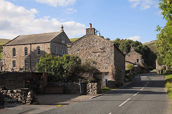
Gunnerside village
My plan was to walk from Gunnerside up Gunnerside Gill to the foot of Bunton Hush, then climb up onto Melbecks Moor and return back to Gunnerside. All in all thats about 6.5 miles.
In the village, next to the bridge over Gunnerside Beck, there are spaces for about ten cars to park. There was just one free space when I arrived one Sunday morning – a good start!
The area where all the mineshafts and levels were dug is further upstream from here and the footpath leading to them starts from the opposite side of Gunnerside Beck. On crossing the bridge a fingerpost pointing upstream shows the way. For the first mile or so the path wanders through the fantastic old woodland of Birkbeck Wood. I’m guessing that the seams of galena (lead ore) in this area were too deep to be profitably mined as the woodland appears very old and undisturbed.
Sir Francis Mine
On leaving the woodland the landscape changes very quickly though. After walking through a couple of farm fields the remnants of the first of the Gunnerside lead mines come into view.
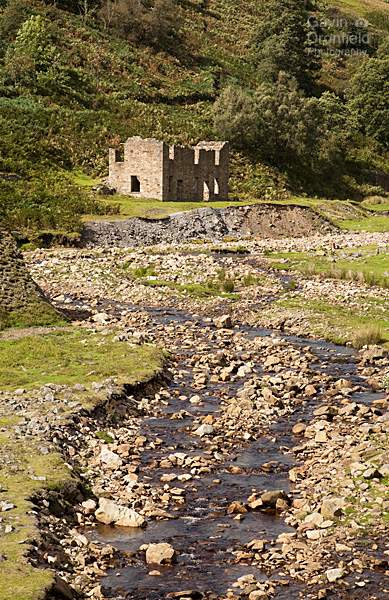
A part of Sir Francis Mine, the first of the Gunnerside lead mines
Sir Francis Mine was in operation for less than twenty years, ultimately being rendered unprofitable by cheaper imports. As the galena seam was underground a shaft had to be dug down to it before extracting it. This meant the impact on the surface wasn’t as great as further up the valley. Apparently the network of underground shafts and tunnels are quite extensive and very impressive. Sadly I didn’t have the right equipment with me to investigate further. Maybe next time.
Hushing at Bunton Mine
Pressing on, the path beyond Sir Francis Mine climbs part way up the valley side, Swina Bank, before the impressive Bunton Mine comes into view.
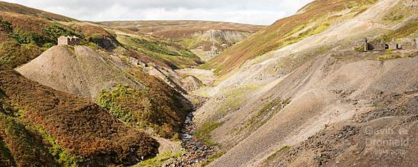
Bunton Mine, the second of the Gunnerside lead mines
What a mess! A very impressive mess but a mess nonetheless. As a lover of natural landscapes, views like this should send a shudder down my spine but they don’t. I love them, possibly because of the contrast they present with the surrounding natural landscape. If the mining was still ongoing it might be different matter but gradually nature is reclaiming what’s there. It will take many more years, if not centuries, before it finishes the job though.
Lead has been mined in the Gunnerside area since Roman times. However mining on an industrial scale only really started in the late eighteenth century. Bunton Mine itself was in operation during the nineteenth century, between 1802 and 1898.
Unlike the area further downstream, the lead ore seams at this point in the valley were quite close to the surface. Shafts and levels were still used to gain access to the valuable rock. But it is a technique called ‘hushing’ that accounts for most of the damage on the surface. Where the galena seam wasn’t so deep a gully was dug further up the slope. This was then blocked with turf dams that were removed when enough water had built up behind them. The resultant torrent of water would remove all the topsoil to expose the lead-rich rock beneath. The resultant rocky scar is called a ‘hush’, Bunton Hush in this case.
The weather on the day of my visit was changeable to say the least. It was very windy so the clouds were moving quite quickly. Consequently if the light wasn’t right for a photo I only had a short wait until it was.
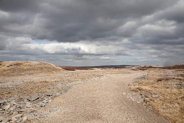
Melbecks Moor back to Gunnerside Village
My route from the old mine took me up one of the rocky gullies that form Bunton Hush and onto the Merry Field mining area on Melbecks Moor.
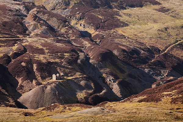
Looking back down on what can be seen of Bunton Mine from the top of one of the hushes
The views from here are impressive, over a heavily mined and incredibly bleak landscape. Actually, I ought to point out at this point that the photos in this blog from Melbecks Moor are from a subsequent visit in winter. Sadly it was much too windy on the tops when I visited in September.
My winter visit was on a very calm day though so I took my time to wander over the devastated moorland.
Track running over devastated Melbecks Moor
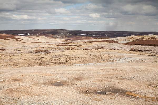
Scars of lead mining on Melbecks Moor
Despite the fact that the view is pretty well ruined and nature is taking years to reclaim it I do find this bleak landscape strangely attractive.
On my September visit, it was only when descending from Melbecks Moor towards the end of my walk that the wind dropped. Wanting to make the most of the now sunny conditions I took a break, admiring the view across Birkbeck wood in the lower reaches of Gunnerside Gill, the first part of the day’s walk.
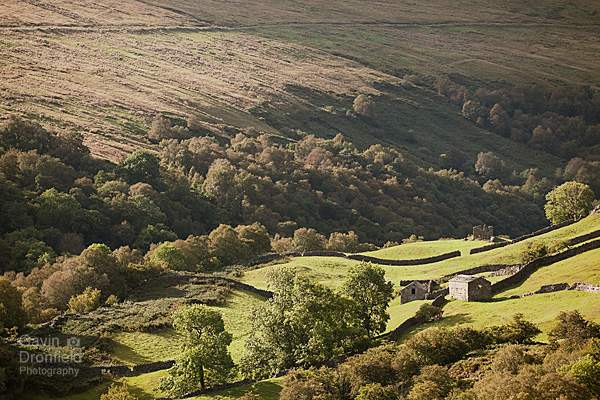
Birkbeck Wood in Gunnerside Gill
After passing the last of the day’s old mine workings the route was an arm-swinging descent on a small lane back to Gunnerside village.
It had been years since I last walked from Gunnerside but I won’t leave it quite so long to the next visit, especially as I think there are many more photographic opportunities in this area. As it is I have already added some of my favourites to my Yorkshire Dales photo gallery.
Further reading:
Subscribe to my newsletter
To receive an email whenever a new blog entry is published please enter your email address below and it will be added to my list:
Your email address will not be shared.