Blea Tarns in the Lake District
The word ‘blea’ is derived from an old Norse word for ‘blue’. Its therefore hardly surprising that there are a number of tarns in the Lake District called ‘Blea Tarn’.
Probably the best known are those above the Langdale and Borrowdale valleys, however there is a much quieter one on the moors above Eskdale. A few years ago I walked past this Blea Tarn on a Saturday evening in summer to find find number of tents pitched nearby. I had never considered this as a decent site to wild camp but maybe it was worth a go? There’s only one way to find out so I hatched a plan to do so. I picked a midweek night in summer though, to ensure it was a bit quieter.
Overnight Parking in Eskdale
I decided to use a route I normally use to get there: an anti-clockwise seven mile walk from the small car park at Trough House Bridge in Eskdale. However, having arrived at the starting point, I noticed a sign saying that no overnight parking was allowed and that this ‘was enforced’! Oh dear. A quick glance at my map and a Plan B was quickly formed.
After a short drive I started again having parked in the small lay-by a mile or so further up Eskdale near Christcliff Farm.

Lay-by near Christcliff Farm
It was late on in the afternoon as I wanted to be at Blea Tarn for sunset but thankfully I had allowed for a few delays.
Walking back down the valley road towards Boot I turned right at the old school house to Trough House Bridge and Dalegarth Hall.
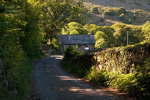
Looking back along the lane towards the old school house in Boot
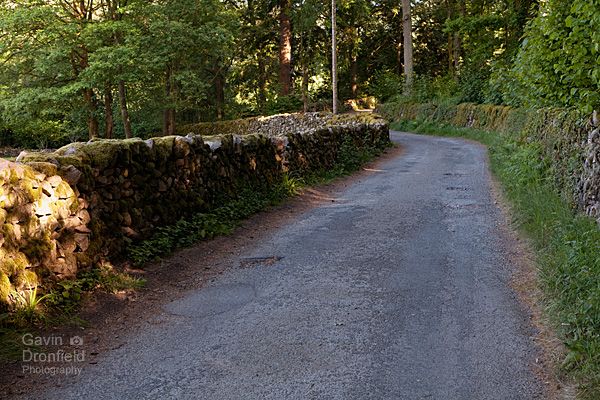
The lane heading towards Trough House Bridge car park
And about thirty minutes after I had intended to start my walk I reached the car park at Trough House Bridge and the walk proper started.
Walking along the River Esk from Trough Bridge
The walk down the Esk Valley from here first leads past Dalegarth Hall.
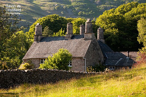
Dalegarth Hall and its impressive chimneys
The current building dates from the 16th Century although there has been a building here since the 14th. The hall is Grade 2 listed and its not hard to see why. Just look at those chimneys for starters!
After a bite to eat, I walked on along the path running parallel to the River Esk through verdant Low Wood, the river being somewhere off to the right.

The footpath through Low Wood
About a mile further on the river and path run next to each other. Not far beyond this point a path off to the right leads over the river via a suspension bridge and up to Fisherground Farm.

Suspension bridge over the River Esk
Climbing up to Blea Tarn above Eskdale
Having walked round through the farm the next obstacle is the Eskdale Railway line.

Crossing over the Eskdale Railway line near Fisherground Farm
The Eskdale and Ravelglass Steam Railway, known locally as L’al Ratty, is a narrow gauge railway that runs for seven miles from Beckfoot in Eskdale down to Ravenglass. It doesn’t run all year round but times can be found on their website.
Taking heed of all the warnings, I looked both ways a number of times before taking a photo and crossing the line. The path leads through a cracking little marshy silver birch woodland via some duck boards to reach a crossroad of footpaths. Turning right here leads to Blea Tarn and pretty much the only climb of the walk.
It was a warm day but fortunately it was so late in the day that the climb was in shade.
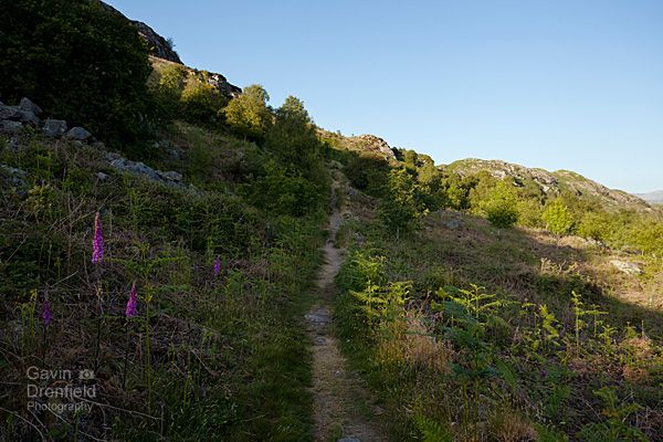
The footpath leading up onto the moors above Eskdale
Its not a long climb but there was no rush so I took my time. And when near the top it was worth a break to enjoy the views back down Eskdale.
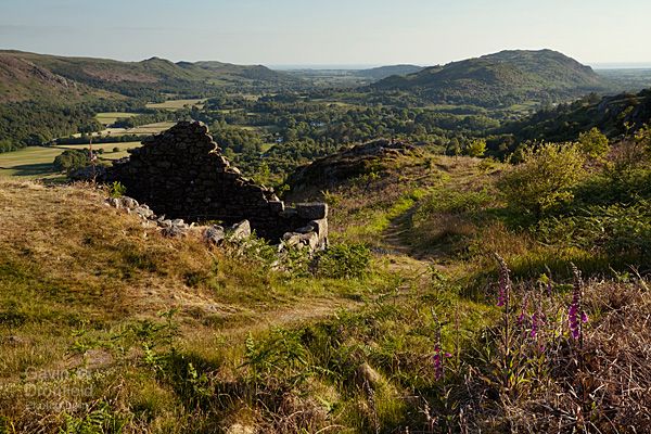
The view from a peat house near the top looking over Eskdale towards Muncaster Fell
After an undulating walk over the upland of Sineytarn Moss, Blea Tarn eventually popped into view.
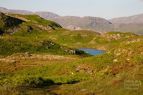
The first view of secluded Blea Tarn
At this point I couldn’t tell if there were any tents there but as I got closer I found out the exact number: zero. Great!
Wild camping at Blea Tarn
Ok, so I had walked past here on a summer’s evening before and seen numerous tents near the footpath around the tarn so I knew there were places where a tent could be pitched. I couldn’t seem to find them though! I’ve never had to wander so far and wide to try to find somewhere dry and flat enough for a comfy night’s sleep!
What I tend to do in this situation is lay my groundsheet down and lie on it, to test how comfy places are but everywhere I tried was as lumpy as hell! At one point a man turned up for a wild swim in Blea Tarn. I’m not sure what he thought I was up to.
Eventually, I settled on the best place I could find so pitched my tent as the sun was setting.

Looking across Blea Tarn to Bleatarn Hill from my tent
The rest of the evening was spent clambering around the crags overlooking the tarn, trying to see if there was a good vantage point for either sunset or sunrise. As I suspected, this was a location that is purely for the wild camper and not really the photographer. The main reason for this is that the tarn is located in a dip surrounded by bigger fells on the horizon. The only long distance views from here were down Eskdale and during the summer the sun sets well to the north of the valley.
I knew from looking at a map beforehand that this was probably the case so wasn’t too disheartened. It was a new camping spot for me and that was the main thing.
Even so, I still grabbed a couple of shots. Firstly a view from the crags overlooking the tarn looking down Eskdale.
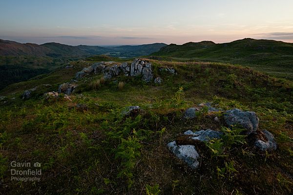
Sunset over the fells surrounding lower Eskdale
And secondly the view looking over Eskdale towards Harter Fell and Green Crag as the sun set.
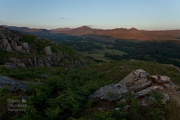
Sunset over the fells surrounding lower Eskdale
Returning to Eskdale from Blea Tarn
In June, the sun rises at the stupidly early hour of just after 04:30 in Cumbria. To be fair though it never really gets dark and I barely ever need a torch. As it also starts getting light well before dawn proper I was packing up my tent around 3am. I had woken up as it wasn’t the most comfy spot and couldn’t get back to sleep so why not?
Consequently I ended up sitting on top of Bleatarn Hill overlooking Blea Tarn to have breakfast as the surrounding landscape gradually got lighter.
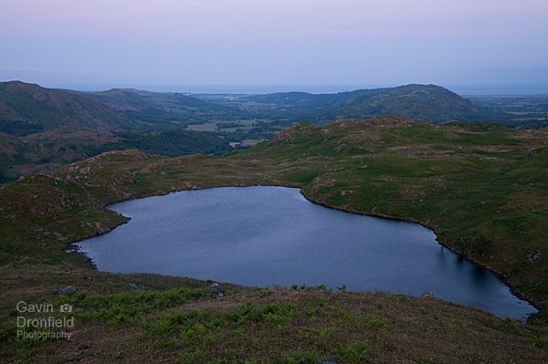
Looking over Blea Tarn from Bleatarn hill
Not a bad way to start the day.
It was going to be another warm day though so having eaten all my food I set off again along the path running along the top of Boot Bank. Ahead of me I could see sunrise was getting close but it was sadly obscured by the small matter of the Scafell massif.
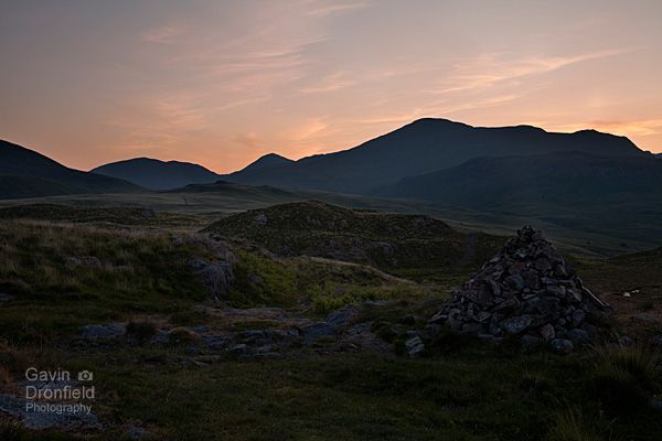
silhouetted sca fell at dawn from eskdale moor
Ah well, someone somewhere was possibly witnessing the great dawn from a decent vantage point but it wasn’t me. Even so, the light was superb.
Further on, as the path descends, a line of ‘peat houses’ popped into view.
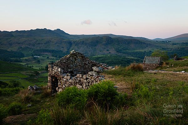
View over Eskdale from peat houses on Boot Bank
Peat houses were used to allow freshly dug out peat to dry before it was carried by packhorses down into the valley where it was used as fuel. The buildings date from the 18th and 19th centuries.
I think the view from peat houses over Eskdale in autumn is better as it is more colourful. Even so the view on this morning was worth a stop as it was so peaceful and quiet.
The track from here drops down Boot Bank into the Whillan Beck Valley and eventually arrives in the small hamlet of Boot.

Eskdale Mill in a very quiet Boot
Nothing was stirring in Boot as I walked through the village, not surprising really considering the time was about 05:30am. I tiptoed by the houses to the main valley road and turned left for the short walk back to the lay-by and my car.

Harter Fell from the road in Eskdale

Looking down Eskdale from the lay-by
So there you go: a wild camp at a tarn I’d never camped at before. Maybe not the best location for a wild camp but certainly very quiet plus the weather stayed dry. If only for those two reasons I’m not going to grumble!
My pictures from this area of the Lakes are all in the Eskdale gallery within my collection of Lake District photography.
Further reading:
Subscribe to my newsletter
To receive an email whenever a new blog entry is published please enter your email address below and it will be added to my list:
Your email address will not be shared.
